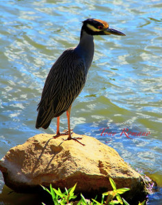
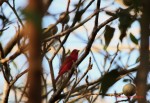
Yesterday, my friend spotted this Egret on a rock. THAT…was way cool. She has this personality you see…
Egret
“Tony, take a photo of this Egret!” So…I did 🙂
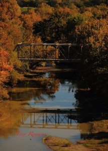
Then today, I took a drive to the Flint Hills. Searched for an old bridge near a dam I remembered seeing back in 2009 but was too cloudy to shoot that day. But, today was clear!
On the walk down a rusty old steel stair way, I stumbled upon a spider spinning a web. That’s was kind of cool!
Spider
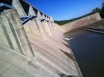
Then, I found some cool concrete stones on the leeward side of the dam.
Concrete Rocks at Dam
After a photo shoot, I decided to drive on the top of the dam and finally found a bridge off to the east I’d been searching for. But, there was no place to stop. You’re not suppose to stop or park in the middle of the road on the dam but…I did! HA! The park ranger was hot on my trail but, I escaped with a nice shot anyway!
This month, I’m back in Nevada for a jaw dropping scenic tour that ultimately led to an old timber mill in the high desert. Located at 7400 foot elevation, the mill operated during the Gold Rush and supplied the town of Belmont and surrounding areas wood supplies to build homes and business and was the fuel that kept everyone warm.
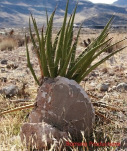
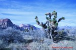
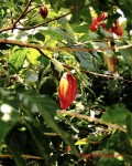
Cactus Rock
There’s so much to see in the desert and while it appears to be just miles and miles of sand and devoid of life, there’s lots of history here and an interesting and intriguing place.
Climate…
Nevada is the driest state in the United States. It is made up of mostly desert and semiarid climate regions and daytime summer temperatures sometimes may rise as high as 125 °F (52 °C) and nighttime winter temperatures may reach as low as −50 °F (−46 °C). While winters in northern Nevada are long and fairly cold, the winter season in the southern part of the state tends to be of short duration and mild. Most parts of Nevada receive scarce precipitation during the year. Most rain that falls in the state falls on the lee side (east and northeast slopes) of the Sierra Nevada.
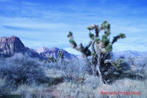
Joshua Tree
The average annual rainfall per year is about 7 inches (18 cm); the wettest parts get around 40 inches (100 cm). Nevada’s highest recorded temperature is 125 °F (52 °C) at Laughlin on June 29, 1994 and the lowest recorded temperature is −50 °F (−46 °C) at San Jacinto on January 8, 1937. Nevada’s 125 °F (52 °C) reading is the third highest temperature recorded in the US just behind Arizona’s 128 °F (53 °C) reading and California’s 134 °F (57 °C) reading.
ETYMOLOGY:
Legend has it that the Mormons named the yucca brevifolia the Joshua Tree : (from the resemblance of the tree’s greatly extended branches to Joshua’s outstretched arm as he pointed with his spear to the city of Ai (Joshua 8:18) .
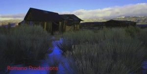
Old Wood and Sod House
To see historical settlers homes still standing for nearly 150 years is amazing considering the extreme conditions in this desert region.
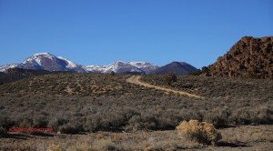
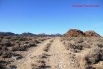
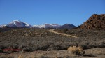
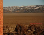
On the way to the Old Mill
Driving along dusty and rocky back roads, there’s snow-covered mountains with small hills in the forefront. If you notice, there are hundreds of small vertical looking brown rock things.
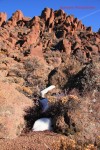
These are called hoodoos. ‘Hoodoos’ are tall skinny spires of rock that protrude from the bottom of arid basins and “broken” lands. Hoodoos or Goblins as they are called are one of the most spectacular displays of erosion. They are geological formations, rocks protruding upwards from the bedrock like some mythical beings, conveying the story of hundreds and thousands of years of weather erosion.
Hoodoos
Most Hoodoos are made of sandstone, sand-sized particles cemented together by calcite, silica, or iron oxide. They are created by erosion. Rains, running water and strong sand winds slowly chip away the material from the bedrock.
As some parts of the sandstone are stronger than others, uneven shapes of remains begin forming.
Most of the time Hoodoos have a very hard rock on the top, called the Cap-rock which protects the softer sandstone layers beneath it from further erosion. That is why Hoodoos usually appear as ‘spikey’, ‘human’ looking formations ranging in size from that of a human to that of a ten story building.
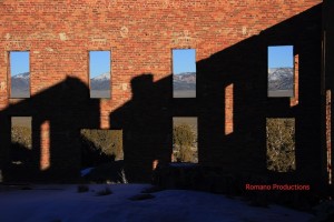
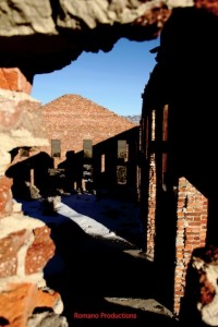
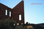
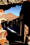
Old Mil
The old mill was still standing despite removal of all its timbers, steel lintels, wood doors and windows throughout the years.
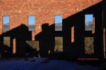
Snapping a few photos from the leeward side of the sunset as shadows cast on the backdrop of Table Top Mountain was truly a site to see.
Old Mill
It was dead quiet inside the mill and for a moment, I thought I heard voices…
Maybe, it’s because Belmont’s a Ghost Town, or maybe, just maybe, it’s because, I was standing there alone and the fantasy of how it use to be a thriving town of 15,000 people played back in my mind, a place of opportunity full of stories back in the day …
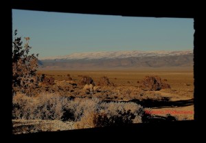
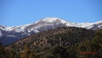
Whatever it was, the panoramic view from the old mill paints a vivid picture, that once upon a time mountains surrounding this desert valley was filled with trees and Belmont was a very prosperous wild west town to live in.
Table Top Mountain
Once upon a time…
Back in the day…
***TO ENLARGE PHOTOS – “CLICK” WITHIN GALLERY BELOW ***
Traveling from the Pacific Ocean, through rain forest, dry forest and valleys, I found it truly amazing how one country the size of West Virginia has such a vast landscape and several climates.
Bananas everywhere!
With many different types of animal, bird and plant species, volcanos and the magnificent Caribbean Sea on its eastern border and the gorgeous Pacific Ocean on the West, it’s no wonder so many people from around the world visit Costa Rica’s paradise each and every year.
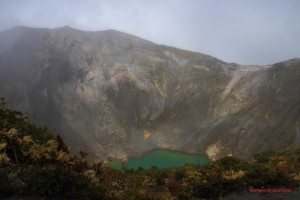
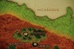
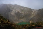
Irazu Volcano
If you’re not familiar with Costa Rica, it’s the volcanos that created the landscape. Looking at the map, you’ll see them lined up, kind of in the middle of the country. The photo (right) is Irazu, one of six Costa Rican active Volcanos.
Central Valley Coffee Region
After a 5 hour bus ride from Tamarindo, I finally arrived in the capital city of San Jose.
I’ve always been in love with great coffee and today was a history lesson at the Britt Coffee Plantation in Heredia, Costa Rica just a short drive away…
Coffee Beans in transit
Coffee originated in Ethiopia in S VIII-XV, then Saudi Arabia in SXVI, Italy in 1615, France in 1660, Martinique in 1723, Brazil 1727 and finally Costa Rica in 1750.
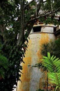
Museo Nacional Costa Rica
The next stop was The Museo Nacional Costa Rica in downtown San Jose. It’s amazing that so many people bypass these historic places but, I’m guessing it’s because San Jose isn’t on the list of great places to visit according to the internet and most travel agencies. And, I suppose for most people, it’s looked upon as a large congested hub city that most fly in or out of to get where they’re ultimately going. However, there are several museums within a short distance of each that provide plenty of history to foreigners. As the taxi pulled up to the museum, I noticed bullet holes on the walls and immediately began snapping photographs. This building use to be the military headquarters before its demise in 1948 during Costa Rica’s civil war. And, as I stood in front of this old building full of stories, in a country without a military, I wondered why America lives in such fear that their weapons will be taken away…
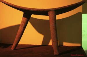
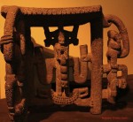
Furniture from Volcanic rock
Anyway, as I walked from building to building learning about ancient Costa Rican artists and their talents way back when, I remembered the Volcanic rock on many of the Pacific beaches I’d visited the past six weeks. What an amazing art form, carving furniture out of Volcanic rock!
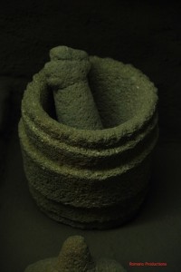
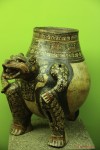
Mortar of Volcanic rock
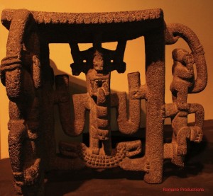
Check this out: Grinding stones or platforms (hereafter metates) and the mullers or hand stones used on them were made of porous volcanic rock. The grinding process and water produced a doughy mass usually of maize, but also of certain other seeds and tubers, like cassava. Grinding stone against stone produced recognizable patterns of friction wear. Both metates and mullers (manos) became common in the archaeological record approximately 500B.C., and their sculpted forms are recognizable as coming from different regions of Costa Rica. Check out the cool face under the table to the right! Cool huh?
Table made with Volcanic rock
There were also special purpose ceremonial metates and in fact became the favored form for high-status sculpture during this period. These metates highlighted the importance of the control over agriculture and its products as a major power base for the leaders. I think the leaders back then were cool! Anyway… Such metates were destined for only occasional ceremonial use, and in fact some of them may have been utilized as altars for display or even seats for powerful leaders during these ceremonies!
In this period, the ceremonial metates of NW Costa Rica highlighted carving on the underside of the working grinding plaste.
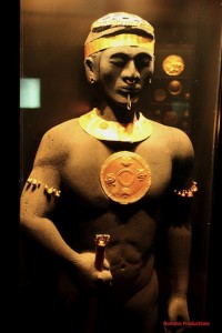
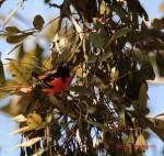
Chief
Some of these very complex carvings show ritually costumed high-ranking shamans or chiefs with fancy headdresses, feathered capes, staffs, weapons and other intricate clothing of leather and cloth.
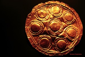
“Bling Bling”.
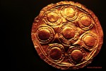
Golden Object
In Costa Rica, the oldest golden objects date from the first century after the time of Christ, and were made with techniques that originated in Panama and Colombia.
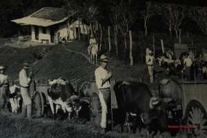
Colonial Costa Rica
Colonial Costa Rica
The colonial period in Costa Rica was characterized by a relative situation of isolation and poverty that affected commerce and the acquisition of produce goods from other provinces. This situation is a reflection of the austerity of that period which contributed directly to forge Costa Rica’s way of being.